
Board Manual - 8/2013 Forest Roads
Section 3
Guidelines for Forest Roads
PART 1. OVERVIEW .................................................................................................................... 2
PART 2. ROAD MAINTENANCE AND ABANDONMENT PLANNING ................................ 2
2.1 Road Maintenance and Abandonment Plans ........................................................................ 2
2.2 Changes in Ownership .......................................................................................................... 9
2.3 Family Forest Fish Passage Program .................................................................................... 9
PART 3. ROAD LOCATION AND DESIGN ............................................................................... 9
3.1 Location BMPs ..................................................................................................................... 9
3.2 Design BMPs ...................................................................................................................... 10
Figure 3.1 Road shape designs ............................................................................................. 11
Table 3.1 Comparison Chart for Road Shape ....................................................................... 12
PART 4. ROAD CONSTRUCTION AND MAINTENANCE .................................................... 13
4.1 General Construction BMPs ............................................................................................... 13
4.2 Compaction and Stabilization ............................................................................................. 13
4.3 Erosion Control ................................................................................................................... 14
4.4 Sediment Control ................................................................................................................ 15
4.5 Vegetation BMPs ................................................................................................................ 15
4.6 Grading ............................................................................................................................... 16
4.7 Roadside Vegetation Maintenance ..................................................................................... 16
PART 5. LANDINGS ................................................................................................................... 17
PART 6. DRAINAGE STRUCTURES ....................................................................................... 17
Table 3.2 Comparison of Drainage Structures ...................................................................... 19
6.1 Relief Culverts .................................................................................................................... 19
6.2 Dips ..................................................................................................................................... 20
Figure 3.2 Diagram of a rolling dip ..................................................................................... 20
6.3 Water Bars .......................................................................................................................... 20
Figure 3.3 Diagram of a water bar ...................................................................................... 21
6.4 Drainage Diversions............................................................................................................ 21
Figure 3.4 Diagram of rubber strip diversion structure....................................................... 22
6.5 Ditches ................................................................................................................................ 22
6.6 Energy Dissipaters .............................................................................................................. 22
PART 7. ROAD ABANDONMENT ............................................................................................ 23
7.1 Prioritizing Roads for Abandonment .................................................................................. 23
7.2 Side Cast and Fill Removal BMPs...................................................................................... 23
7.3 Water Crossing Removal BMPs ......................................................................................... 23
7.4 Drainage BMPs ................................................................................................................... 23
PART 8. ROCK PITS AND QUARRIES .................................................................................... 24
GLOSSARY ................................................................................................................................. 25
Figure 3.5 Diagram demonstrating full bench construction. ............................................... 25
Figure 3.6 Diagram showing the road prism. ...................................................................... 26
RESOURCES ............................................................................................................................... 27
B3-1

Forest Roads Board Manual-8/2013
PART 1. OVERVIEW
Background
Historically, studies have identified forest roads as sources of sediment delivery to streams in
Washington’s forests. Roads can deliver sediment for a variety of reasons including past
practices, neglected maintenance, natural processes, and catastrophic events.
Introduction
This manual provides guidelines to help implement the forest practices road construction and
maintenance rules. Correct implementation of current forest practices rules is assumed to
minimize runoff water and sediment delivery to typed waters.
Research has demonstrated that well designed and properly maintained roads minimize impacts
to public resources and at the same time, reduce operating costs. This manual includes Best
Management Practices (BMPs) for forest road location, design, construction, and maintenance
(which includes abandonment). The BMPs are grouped into types of activity. For example, ditch
construction and maintenance are both under the topic “Ditches.”
The listed BMPs will not address every situation nor are all BMPs appropriate for every road.
The intent of the BMPs is to provide decision makers with as much flexibility and choice as
possible in planning road design, construction, and maintenance activities. If the listed BMPs do
not address your situation, you may propose site-specific solutions to the Department of Natural
Resources (DNR).
Use of BMPs depends on many factors, including the potential to cause damage to a public
resource. For example, timber hauling on a road near a stream may require a higher level of
maintenance than a road located away from a stream.
A forest practice activity that includes construction or performance of work within the stream
bed or bank of any S, F or N Water is considered a forest practices hydraulic project (FPHP) and
may require a FPA (see WAC 222-16-050). For guidelines on planning and designing hydraulic
projects, see Board Manual Section 5, Guidelines for Forest Practices Hydraulic Projects.
The manual also provides information on Road Maintenance and Abandonment Plans (RMAPs)
and the Family Forest Fish Passage Program. All italicized words are in the attached glossary.
PART 2. ROAD MAINTENANCE AND ABANDONMENT PLANNING
2.1 Road Maintenance and Abandonment Plans
Road maintenance and abandonment plans (RMAPs) are required for all forest landowners.
Large forest landowners must prepare a full RMAP for all of their ownership per WAC 222-24-
051 and small forest landowners must follow the RMAP requirements in WAC 222-24-0511.
Landowners submit RMAPs to the DNR.
Forest landowners are responsible for maintaining all of their forest roads to the extent necessary
to prevent potential or actual damage to public resources. This includes both forest roads listed
within an RMAP and those forest roads that are exempt from RMAP requirements, such as 80/20
small forest landowners (SFL). The 80/20 SFLs are those who own a total of eighty acres or less
of forest land and are not required to submit an RMAP for any block of forest land that contains
B3-2

Board Manual - 8/2013 Forest Roads
twenty contiguous acres or less (WAC 222-24-0511). The type and extent of an RMAP depends
on whether a landowner is classified as a large or small forest landowner. See WAC 222-16-
010, for the complete definition of “forest landowner.”
Large forest landowners are defined in rule as harvesting more than two million board feet of
timber per year from their forest land in Washington State. Large forest landowner RMAP
requirements are described in WAC 222-24-051.
• All large forest landowner forest roads under ownership at that time were included in
approved RMAPs by July 1, 2006. Part 2.2 of this manual addresses how landowners amend
RMAPs to include forest lands acquired since 2006.
• Road work in the approved RMAPs need to be completed by October 31, 2016 or by the
extension deadline October 31, 2021 if approved by DNR per WAC 222-24-051(8).
Small forest landowners are defined in rule as landowners that:
• Harvest an annual average of two million board feet or less of timber from their forest land in
Washington State;
• Have harvested at this level for the past three years; and
• Do not plan to exceed this annual average harvest level for the next 10 years, WAC 222-16-
010.
For SFLs that do not meet an exemption to increase their annual timber harvest level over two
million board feet, an RMAP will be required for their property (RCW 76.13.120).
SFL RMAP requirements are based on the size of forest land holdings (WAC 222-24-0511).
• DNR provides all SFLs with an educational brochure outlining road maintenance standards
and requirements, regardless of whether or not the landowner has an RMAP or is required to
complete a checklist RMAP with their forest practices application/notification (FPA/N) for
harvest (RCW 76.09.420).
• No RMAP is required for 80/20 SFLs.
• A checklist RMAP is required with each FPA/N for timber harvest (including salvage) for
SFLs that have ownership greater than 80 acres or have an individual parcel more than 20
contiguous acres.
• If an SFL submits an RMAP, other than a checklist RMAP, the following options apply:
o Follow the RMAP schedule.
o Ask DNR to approve changes to the RMAP schedule.
o Cancel the RMAP by providing written notification to DNR. After cancelation of a
RMAP all future timber harvest FPA/Ns must include an RMAP checklist.
RMAP Review
The Departments of Ecology and Fish and Wildlife, affected tribes, and interested parties
(stakeholders) have the opportunity to review existing approved RMAPs, revised RMAPs
prepared for extension requests, and annual work plans and schedules for forest landowner road
systems. Formal review opportunities for stakeholders will be offered prior to DNR’s decision to
approve/disapprove an RMAP extension and/or annual work plans. Early, informal
communication is encouraged between forest landowners and stakeholders about road concerns
and priorities to help prepare all parties for the review.
B3-3

Forest Roads Board Manual-8/2013
Stakeholders will receive copies of all written documentation addressing changes to approved
RMAPs.
RMAP Extension
Large forest landowners operating under an RMAP, and small forest landowners who choose to
operate under an RMAP, may apply for an extension of their RMAP completion deadline for up
to five years (October 31, 2021). Landowners are strongly encouraged to provide adequate time
for DNR and all other reviewers to assess the extension area for the revised RMAP. If the
landowner’s property is not accessible due to conditions such as inclement weather conditions,
the extension may not be approved. Landowners are encouraged to submit their extension
requests as early as possible. The last date an RMAP extension can be requested is 120 days
prior to the initial RMAP’s anniversary date in 2014. Upon receipt of a complete extension
request, stakeholders will have at least 45 days to review a revised RMAP. See timeline below.
Requests for an RMAP extension require a revised RMAP that contains the following:
• Extension request form,
• Prioritization and tracking form,
• Maintenance and storm strategy form,
• Accomplishment scheduling worksheet (this schedule demonstrates all remaining RMAP
work that will be completed through the extension performance period),
• Annual accomplishment and planning report (summary of all RMAP work), and
• Map(s), specific to the extension request area, showing fish passage barriers and road
segments requiring work.
All the standardized forms listed above and detailed instructions on how to fill out the forms are
available on DNR’s website at
www.dnr.wa.gov/BusinessPermits/Topics/ForestPracticesApplications/Pages/fp_forms.aspx.
Submit Extension
Request &
Revised RMAP
Packet
Stakeholder
Review
DNR Review &
Meet w/
Landowner
DNR Extension
Decision
Landowner Annual
Work Plan
Preparation
Stakeholder &
DNR Review of
Annual
Worksheet/Report
120 Days Prior
to the
Anniversary
Date
75 Days Prior to
the Anniversary
Date
30 Days Prior to
the Anniversary
Date
Landowner Submits Annual
Accomplishment Worksheet and
Annual Accomplishment and
Planning Report
45 Days
DNR Decision
Day 0
RMAP
Anniversary
Date
B3-4

Board Manual - 8/2013 Forest Roads
The revised RMAP needs to contain the following elements documented on the applicable forms
and map(s):
1. An adjusted RMAP accomplishment scheduling worksheet describing how remaining work
will be completed on a generally even-flow basis by the extension deadline. The RMAP
accomplishment schedule shows how all remaining work will be prioritized using the worst
first principle (how the worst problems will be addressed as the highest priority per WAC
222-24-051(3), (4) and (6)), see Prioritizing RMAP Work section below. Required road work
that is scheduled needs to correspond with locations shown on the forest landowners’ maps.
2. Assessment and documentation on the RMAP accomplishment scheduling worksheet of all
remaining fish passage barriers, including the dates that fish passage barriers have been
removed or fixed. The accomplishment scheduling worksheet needs to demonstrate how the
work is being completed consistently on a generally even-flow basis throughout the
remaining performance period. This will avoid planning and completing a disproportionate
majority of the work at the end of the extended RMAP performance period. Scheduled fish
passage barrier work needs to correspond with point locations shown on the forest
landowners’ maps.
3. Maps showing an inventory of existing conditions for the road system. Road locations need
to correspond to the work listed in the adjusted scheduling worksheet. For consistent
reporting, use DNR Section or Township base maps (or other comparable map(s); or DNR
compatible GIS map products). DNR will accept a range of map(s) from 1:12,000 through
1:60,000 scale. The following elements need to be included on each map:
• Current existing RMAP boundary as well as the boundaries for the RMAP extension
area(s).
• All forest roads including:
o Roads and/or road segments requiring work to meet forest practices rule standards.
o Roads and/or road segments proposed for abandonment (WAC 222-24-052(3)).
o Stream adjacent parallel roads (identify segments) (WAC 222-16-010).
o Orphaned roads, and specify those with potential resource risks.
• All fish passage barrier locations.
• Type A and B wetlands, as identified on the DNR forest practices wetland GIS layer that
lie adjacent to or are crossed by roads.
• Stream locations and water type(s) as identified on the DNR hydrography GIS layer.
Landowners may place additional work elements on the map that have been included in their
RMAP accomplishment scheduling worksheet, such as replacing or removing undersized
water crossing structures (non fish) or other road work necessary to minimize sedimentation
to typed waters or wetlands (e.g., sidecast pullback, surface water management, etc.).
Field Assessment and Screening
Landowners will need to complete an on-the-ground assessment of any portion of the road
system that has not already been assessed or when the initial assessment has been rendered
inadequate because of major changes that occurred before the RMAP work was complete (e.g.,
storm damage, landslides or new property acquisition).
B3-5

Forest Roads Board Manual-8/2013
The on-the-ground assessment should include, but is not limited to review of the following
elements associated with each road segment not meeting current forest practices rule standards:
1. Barriers to fish passage. Water crossing structures need to pass all fish at all life stages
(WAC 222-24-010(2)).
2. Undersized culverts or other inadequate water crossing structures on non-fish habitat streams.
3. Mass wasting (landslides) from unstable areas that are affected by roads and threaten public
resources and/or public safety.
4. Sediment delivery to typed waters or wetlands.
5. Stream adjacent parallel roads.
6. Interruption of natural drainage patterns where roads intercept springs, seeps, and typed
water; including water that is routed out of its natural channel or flow pattern.
7. Road ditches that drain into streams or wetlands.
Refer to the maintenance and storm strategy form for more detailed guidance on road
assessment. The form is located at
www.dnr.wa.gov/BusinessPermits/Topics/ForestPracticesApplications/Pages/fp_forms.aspx.
Prioritizing RMAP Work
Prioritization needs to address the worst situations first, that is, on areas with the highest
potential to damage public resources. Prioritization can take place after landowners assess road
improvement work needed. In assessing priorities, landowners should consider locations where
many small problems exist, and when combined, increase the potential to harm public resources
at the watershed scale. Landowners are encouraged to work with the Departments of Ecology
and Fish and Wildlife, affected tribes, and interested parties on prioritizing their RMAP work;
this will facilitate the efficiency of RMAP review.
Work schedules within RMAPs should be based on each landowner’s RMAP priorities (not
necessarily in this order):
1. Restoration of fish passage beginning with barriers that affect the most stream miles of fish
habitat above the blockage.
2. Repair or maintenance work to reduce sediment delivery from surface erosion and/or mass
wasting.
3. Repair or maintenance work to disconnect road drainage(s) from streams.
4. Repair, maintenance, relocation, or abandonment of stream-adjacent parallel roads with an
emphasis on reducing water and sediment delivery from the road to the stream.
5. Repair or maintenance work which keeps streams in their natural channels, route
groundwater onto the forest floor, and drains ditchwater onto the forest floor and not into the
stream.
B3-6

Board Manual - 8/2013 Forest Roads
6. Repair or maintenance work which can be undertaken with the maximum operational
efficiencies, getting the maximum amount of work done with available landowner funds, and
achieving the most improvement in resource protection as early as possible in the planning
period.
RMAP Annual Review
Each year on the anniversary date of the plan’s submittal, landowners need to report in the forms
listed below a current RMAP summary, work accomplishments for the previous year, work
proposed for the upcoming year. Any modifications, including storm damage, landslides or new
property acquisition (Part 2.2), need to be incorporated into both forms
• Annual accomplishment and planning report (summary of all RMAP work), and
• Accomplishment scheduling worksheet (work accomplishments for the previous year, work
proposed for the upcoming year, and any modifications to the existing plan)
The forms and instructions on how to fill out these forms are available on DNR’s website at
www.dnr.wa.gov/BusinessPermits/Topics/ForestPracticesApplications/Pages/fp_forms.aspx
.
The annual accomplishment and planning report needs to illustrate the cumulative progress
towards achieving the scheduled RMAP goal to determine if even flow is being met through
reporting the percentage of roads improvement completed in each road management block
contained within landowners RMAP. In order to meet the requirements in WAC 222-24-051, the
annual accomplishment and planning report and the accomplishment scheduling worksheet need
to include the following:
1. An annual accomplishment and planning report identifying:
• Total miles of road within the plan, as well as miles of completed road improvement from
the previous year and proposed road improvement for the upcoming year.
• Total miles of roads needing abandonment, as well as miles of completed road
abandonment from the previous year and proposed road abandonment for the upcoming
year.
• Total miles of orphan road within the plan, as well as miles of orphan road mitigated
from the previous year and roads proposed for mitigation in the upcoming year.
• Total number of fish passage barriers within the current RMAP.
• Total number of fish passage barriers that have been removed/fixed from the previous
year and barriers that have been proposed to be removed/fixed in the upcoming year.
• Approximate number of stream miles of fish habitat access restored.
Locations of the RMAP work listed above needs to be documented on Geographic
Information System (GIS) shapefile, electronic spreadsheet, and/or paper map(s).
2. All scheduled work within the last planning period that was not completed as specified on the
accomplishment scheduling worksheet. The accomplishment scheduling worksheet needs to
show how this work has been rescheduled for completion in subsequent years.
3. Any additional information pertaining to work that needs to be added or removed on the plan
(e.g., purchasing new lands, storm damage, or unforeseen circumstances that have altered
existing road networks that have not been brought up to forest practices rule standards) needs
B3-7

Forest Roads Board Manual-8/2013
to be explained on the annual accomplishment and planning report and added to the
accomplishment scheduling worksheet.
4. Detailed scheduling information relating to work that is to occur within the next year (i.e.,
before the next accomplishment scheduling worksheet).
The DNR, in consultation with Departments of Ecology and Fish and Wildlife, affected tribes,
and other interested parties will review the progress of the RMAP on an annual basis to
determine if the RMAP is being implemented as approved. The DNR will notify the landowner
about any concerns that may need further work or approval within 45 days of receiving the
annual accomplishment and planning report and accomplishment scheduling worksheet.
Review and Reporting of RMAP Data
Data is reported by landowner’s on revised RMAPs, annual reports and schedules, and is
reviewed by DNR, landowners, and stakeholders. Landowner RMAP information is submitted to
DNR on standardized forms, paper maps, electronic spreadsheet(s), and/or GIS spatial formats.
After verifying that RMAP reports are complete and include all required elements, DNR will
distribute the RMAP materials to the stakeholders for review.
The DNR distributes to stakeholders and publishes the annual forest practices habitat
conservation plan (HCP) report summarizing annual RMAP work accomplished. The annual
RMAP accomplishment report consists of RMAP data collected by each region which is
combined to provide stakeholders with a statewide picture of the RMAP program status. The
annual forest practices HCP report is located on DNR’s Forest Practices website at
http://www.dnr.wa.gov/BusinessPermits/ForestPractices/Pages/Home.aspx.
DNR has created an RMAP database to track large landowners’ progress towards meeting
RMAP obligations. RMAP stakeholders can use the database to review the work being
completed by landowners on their RMAP(s). A year is assigned to each data location,
communicating when the work is planned or was completed. This database can be represented
spatially in GIS which will allow stakeholders to run limited queries on a watershed basis. This
database and its narrative can be found on the DNR’s website at
www.dnr.wa.gov/BusinessPermits/ForestPractices/Pages/Home.aspx.
RMAP Completion
Landowner’s RMAPs will be considered complete when all roads within the RMAP have been
brought up to forest practices rules standards and validated by DNR. The following elements
describe the process DNR will follow.
• DNR will consult with the Departments of Ecology and Fish and Wildlife, affected tribes,
and interested parties prior to issuing a final acceptance of the RMAP.
• DNR will provide, in writing, confirmation to the landowner that the RMAP(s) is complete.
• Written confirmation of completion will be distributed to the Departments of Ecology and
Fish and Wildlife, affected tribes, and interested parties.
Upon completion of an RMAP, landowners will maintain all existing roads according to forest
practices rules standards.
B3-8

Board Manual - 8/2013 Forest Roads
2.2 Changes in Ownership
An approved RMAP is a continuing forest land obligation only for large forest landowners per
WAC 222-20-055.
If you are a large forest landowner and purchase forest land with an RMAP, you have the
following options:
• Follow the RMAP schedule.
• Ask DNR to approve changes to the RMAP schedule.
If you are a large forest landowner and purchase forest land without an RMAP, contact DNR for
assistance in developing a plan and maintenance schedule.
If you are a small forest landowner and purchase land with an RMAP (other than a checklist
RMAP), you have the following options:
• Follow the RMAP schedule.
• Ask DNR to approve changes to the RMAP schedule.
• Ask DNR to cancel the RMAP.
2.3 Family Forest Fish Passage Program
Small forest landowners are eligible for the Family Forest Fish Passage Program. This voluntary
cost-share program provides financial assistance for removing fish passage barriers and
replacing them with fish passable structures. The fish passage barrier must be located on forest
land and cross a Type S or F Water.
A fish passage barrier is determined by the state and is any artificial (human-caused) in-stream
structure that impedes the free passage of fish. “Fish” includes all life stages of resident and
anadromous fish. Cost share rates range from 75%-100%.
For an application and information, see www.dnr.wa.gov/fffpp or contact the Small Forest
Landowner’s Office at any DNR region office.
PART 3. ROAD LOCATION AND DESIGN
(Rules are in WAC 222-24-015, WAC 222-24-020, and WAC 222-24-026.)
The location of a road may have long-term effects on construction and maintenance costs, safety,
and public resources. A well located, designed, and constructed road balances current and future
needs with construction and maintenance costs. Base the final road location on field verified
information, BMPs, and local knowledge.
3.1 Location BMPs
When necessary to cross water, find the optimal water crossings first and locate roads to:
• Utilize topographic features such as benches, ridges, and saddles.
• Use natural grade breaks to locate drainage structures. This prevents long continuous ditches.
• Avoid crossing or constructing roads adjacent to wetlands. When wetlands are present, refer
to WAC 222-24-015(1) for an ordered list of choices for road location and construction.
Recommendations on wetland restoration, enhancement or replacement are in Board Manual
Section 9, Guidelines for Wetland Replacement by Substitution or Enhancement.
• Disconnect the road drainage from typed waters.
B3-9

Forest Roads Board Manual-8/2013
Reduce risks to public resources by minimizing the amount of roads in the following locations:
• On side slopes greater than 60%.
o If you plan to construct roads in these areas, you may be required to use full bench
construction techniques.
• On unstable slopes and landforms. For guidance, see Board Manual Section 16, Guidelines
for Evaluating Potentially Unstable Slopes and Landforms.
o If you plan to construct roads in these areas, you may need to perform additional
environmental review (see WAC 222-16-050, Class IV-special).
• In areas with a history of road failures or slides.
o If you plan to construct roads in these areas, research the factors that contributed to the
failures and plan to avoid past road location, construction and maintenance techniques.
You may be required to perform additional environmental review (see Board Manual
Section 16, Guidelines for Evaluating Potentially Unstable Slopes and Landforms and
WAC 222-16-050, Class IV-special).
• Within 200 feet of typed waters.
o Note: New stream adjacent parallel roads require an interdisciplinary team.
• In or near seeps and springs.
o If you plan to construct roads through seeps and springs, maintain the natural flow
patterns around them. The flow pattern often has wetland indicator plants and soils.
3.2 Design BMPs
Once you have selected a road location, design the road to minimize sediment delivery to typed
waters by:
• Including adequate drainage structures for anticipated surface and intercepted sub-surface
flow.
• Ensuring the sub-grade and surface can support log and rock haul during the planned season
of road use.
• Not constructing sunken roads. These are roads lower than the surrounding ground level, and
do not drain properly. Sunken roads occur on gently sloped land where cut and fill is
unnecessary. In these locations, it may be necessary to build up the road surface so that water
drains away from the road surface.
• Incorporating grade breaks to avoid long, continuous road grades.
Design the road shape (crowned, inslope, outslope) to support the anticipated haul of timber,
rock, etc. Figure 3.1 shows cross section views of road sub-grades by type of road shape. Table
3.1 offers a comparison chart to help determine the best road design for your location.
B3-10

Board Manual - 8/2013 Forest Roads
Crowned
Inslope
Outslope
Figure 3.1 Road shape designs
B3-11

Forest Roads Board Manual-8/2013
Table 3.1 Comparison Chart for Road Shape
Inslope
Outslope
Crown
Road surface
shape
Drains towards the cut
slope using the road or
ditches.
Drains towards the fill
slope using dips, not
ditches.
Drains both directions
with high point in center
of road.
Construction
requirements
Requires more
excavation and clearing.
Requires less excavation
and clearing.
Will require excavation
and clearing quantities
between inslope and
outslope.
Maintenance
requirements
Road surface
Ditch and relief
structures
Road surface
Dips
Fill slopes – vegetation
or stabilization
Road surface
Ditch and relief
structures
Fill slopes – vegetation
or stabilization
Erosion
concerns
Road surface
Ditches
At relief culverts and
outlets
Road surface
Fill slope
Dips and dip outlets
Road surface
Ditches
At relief culverts and
outlets
Fill slopes
Where to use
When keeping runoff
water in the ditch is
critical to controlling
sediment delivery.
Unstable or erodible fill
slopes
Steep grades
When hauling in ice or
snow conditions
Rocky or well drained
soils
Where unable to
maintain ditches
Stable fill slopes
On temporary or spur
roads that are less than
8% grade.
Unstable or erodible fill
slopes
Steep grades
When hauling in ice or
snow conditions
High traffic roads
Where not to
use
Where ditches and relief
culverts have high
probability of clogging.
Where ditches cannot be
constructed.
Steep road grades
High traffic roads
Unstable fill slopes
Where safety concerns
exist, such as for use
during ice or snow.
In areas, where
outsloping the road is
adequate.
Temporary roads
B3-12

Board Manual - 8/2013 Forest Roads
PART 4. ROAD CONSTRUCTION AND MAINTENANCE
Road construction techniques are important to prevent potential and actual damage to public
resources.
4.1 General Construction BMPs
(Rules are in WAC 222-24-030)
• Provide road construction operators with well-marked road locations, readable road design
information, and clear instructions.
• Supervise road construction operators to:
o Ensure road width and cut depths match design specifications.
o Respond to unanticipated circumstances.
• Construct roads when moisture and soil conditions are not likely to result in excessive
erosion and/or soil movement.
• Minimize the area of soil disturbance during construction.
• Place all clearing debris and slash (such as tree limbs, stumps and brush) outside the road
prism.
• For roads near typed water, place all clearing debris on the downhill side of the road at the
toe of the road fill. This can trap sediment.
• New, non-compacted roads may need time to settle (several weeks or more) before rock or
timber haul.
• Place a geotextile fabric over an inferior sub-grade before applying the surfacing material.
This spreads vehicle load over the entire sub-grade and helps prevent the surfacing rock from
sinking into the sub-grade soil.
• When crossing wetlands, follow the ordered list of choices for road location and construction
in WAC 222-24-015(1). Recommendations on wetland restoration, enhancement or
replacement are in Board Manual Section 9, Guidelines for Wetland Replacement by
Substitution or Enhancement.
4.2 Compaction and Stabilization
(Rules are in WAC 222-24-030 and WAC 222-24-035.)
General Compaction BMPs
Compaction of the embankment, road sub-grade and landings ensures a solid earthen structure.
• Compacting the embankment reduces potential failure and surface erosion.
• Compacting the sub-grade extends the life of the running surface. It also reduces sediment
runoff from the pumping of fine sediments upward into the road ballast and surfacing.
• Compacting the road surface and landings can shorten the settling time, extend rock surface
life, and reduce sediment production during rainy weather.
For best compaction results:
• Place soil in 1 to 2 foot layers and run excavation equipment over the entire width of the lifts.
• Avoid incorporating organic material into any area to be compacted.
• Compact during optimal soil moisture conditions. Determine this through observation and
experience with different soil types. In soils with silt or clay, ideal soil moisture content is
when you can squeeze the soil into a cohesive ball without having water form on the outside.
B3-13

Forest Roads Board Manual-8/2013
Special Case BMPs
In some instances, apply these additional techniques to enhance the sub-grade and road surface:
• On heavily used roads or where rock is expensive, use a roller to compact the sub-grade and
surfacing. This extends the life of the road by:
o Reducing the water intrusion.
o Reducing the wear.
o Improving the sub-grade’s durability.
o Maintaining the crown.
o Enhancing the surfacing.
For this technique:
• Place surfacing in layers before compacting.
• Compact in several passes depending on the layer thickness. When there is no visible
deformation of the surface, compaction is complete.
• If the sub-grade or surface rock is dry, spray on water or use a roller with a built in spray bar.
• If using a vibratory roller:
o Place surfacing in 4 to 6 inch layers before compacting.
o Compact until a sheen of water and fines rise to the surface.
• Use hard, angular rock that has a full range of fragments to tightly pack the road surfacing.
Stabilization BMPs
Stabilize all disturbed soils that have a potential to deliver sediment to typed waters. Stabilization
methods include establishing vegetation and covering exposed soils with bio-matting, straw, tree
boughs, or hydro mulching.
Waste soil (spoil) deposit areas should be located where material will not enter any typed waters
if erosion or failure occurs. An area with stable, shallow slope topography is best suited for a
spoil area. Compaction of spoil deposit areas reduces potential embankment failures, surface
erosion, and helps fit material into waste areas. Apply the compaction techniques to spoil deposit
areas:
• For best results, handle spoils when they are dry. Handling super-saturated material may
require sediment controls (e. g., silt fence, berms, straw).
• Seed or plant disturbed soils with non-invasive plant species (native plants are preferred).
Consider adding fertilizer and/or mulch if the site has poor nutrient quality and/or organic
content.
4.3 Erosion Control
Erosion control measures are necessary if exposed soils can deliver sediment to typed waters.
The key to controlling sediment is to control erosion. The best way to control erosion is to
prevent it by:
• Covering all exposed soils with non-invasive plant species as soon as possible (native plants
are preferred). Until the area can be vegetated, apply straw, logging slash or fiber mats to the
exposed soil to prevent erosion from raindrop splash. This not only protects and holds soil
particles from the erosive effects of rainfall; it also prevents the spread of noxious weeds.
• Scheduling construction during dry soil conditions.
B3-14

Board Manual - 8/2013 Forest Roads
4.4 Sediment Control
The goal of sediment control is to create a stable, dispersed, non-erosive drainage pattern. This
minimizes potential or actual sediment delivery to typed waters. Where needed, sediment control
BMPs include:
• Excavating dead sumps to intercept and settle sediment-laden water.
• Building sediment traps in ditch lines to create small sediment settling pools. Make sediment
traps from rock, straw wattles, or sand filled bags. Orient the traps so they dip in the center
and curve slightly. This keeps the flow centered in the ditch.
• Installing slash filter windrows to intercept sediment at the toe of fills over water crossings.
• Installing a secondary ditch or a raised berm over water crossings.
• Placing straw wattles, silt fencing, or slash filter windrows perpendicular to the hill slope to
slow down and disperse water flow.
Use sediment traps, silt fences or dead sumps only as temporary or remedial measures because
they require continuous maintenance. Install temporary sediment traps in any of the following
situations:
• If erosion or sediment is likely to deliver to typed waters.
• If roads are built of erosive, native soils.
• If cut and fill slopes are difficult to vegetate.
BMPs for roads within 200 feet of typed water
Apply one or more of the following techniques on roads built of erosive native soils, or are likely
to have ditch erosion, or have cut or fill slopes that are difficult to vegetate:
• Grass seeding.
• Armoring ditches.
• Constructing catch basins.
• Constructing temporary sediment traps.
• Rocking road surfaces near water crossings.
In situations where sediment control devices need to be used long-term consider surfacing that
requires little to no maintenance such as chip sealing or paving portions of roads.
4.5 Vegetation BMPs
Consult with the Natural Resource Conservation Service, a county extension office or a State
resource agency (DNR, Ecology, Agriculture) to determine the type of seeds and/or plants to use.
Factors to consider are:
• Type of soils and soil conditions, including moisture content and degree of compaction.
• Available seed/plant sources (native plants are preferred).
• Costs and methods of seeding or planting.
• Avoiding invasive plant species.
• Matching the time of year the site is accessible with the appropriate planting of seed and/or
plants.
• Topographic aspect, north or south facing slopes.
B3-15

Forest Roads Board Manual-8/2013
When applying grass seed to exposed soils:
• Consider using straw blankets or loose straw if soil moisture is low. Apply straw 3-6 inches
thick.
• Seed during times of year that will allow germination without additional site visits to apply
water.
4.6 Grading
To protect the sub-grade, grade a road before the surface reaches severe stages of pothole
formation, wash boarding, or it begins to pool water. Grade only as needed to maintain the
surface drainage and keep the sub-grade from becoming saturated.
Grading BMPs
• Determine the cause of potholes and wash boarding and fix the problem. The problem is
usually standing water.
o Cut out potholes and wash boarding. Pull road surfacing back onto running surface. This
reduces water penetration and sub-grade saturation. Long-term solutions include restoring
the road crown, adding rock, adding culverts, and ditching to reduce water in the road
prism.
• Remove berms except those needed to carry water away from unstable slopes and/or typed
waters.
• Compacting the graded surface with a roller will:
o Seal the surface and retain fines.
o Reduce potholes.
o Reduce wash boarding.
Avoid the following practices:
• Unnecessary removal of all vegetation in functioning ditches.
• Undercutting the fill or cut slopes.
• Pushing sediment over steep slopes above typed waters.
• Burying vegetation, logging debris and slash into the road running surface or sub-grade.
(Decomposition of this material will leave holes in the road surface. Traffic on this surface
may cause sediment delivery to typed waters.)
4.7 Roadside Vegetation Maintenance
The purpose of roadside vegetation maintenance is to increase visibility, improve safety, control
noxious weeds, and to keep roots from interfering with the roadbed and ditches. Methods include
chemical application, hand brushing, and mechanical brushing.
Roadside chemical application BMPs
• Find and mark the location of all surface waters and wetland management zones immediately
before applying roadside spray.
• Mix chemicals in upland areas away from all typed waters and Type A and B Wetlands.
• Prevent chemicals from entering any surface waters and Type A and B Wetlands and their
buffers.
• Follow all label instructions.
o Know and follow regulations regarding chemical storage, handling, application, and
disposal.
B3-16

Board Manual - 8/2013 Forest Roads
o Develop a contingency plan for spills, including clean-up procedures and proper
notification. Keep this plan on site during operations.
o Apply chemicals during optimum weather conditions and optimum times for control of
target vegetation. See Board Manual Section 12, Guidance for Application of Forest
Chemicals.
Mechanical Brushing BMPs
• Remove brush to a width that allows proper maintenance functions such as grading, trimming
shoulders, pulling ditches, and cleaning headwalls.
• Upon completion, remove all debris and/or slash generated during mechanical brushing that
will interfere with proper function of ditches or culverts.
PART 5. LANDINGS
WAC 222-24-035(1) states, “Locate landings to prevent potential or actual damage to public
resources. Avoid excessive excavation and filling. Landings shall not be located within natural
drainage channels, channel migration zones, RMZ core and inner zones, Type Np RMZs,
sensitive sites, equipment limitation zones, and Type A or B Wetlands or their wetland
management zones.”
Landings can deliver sediment through runoff or mass failures (landslides). Reduce costs and
risks to public resources by minimizing the number of landings on steep erosive slopes or large
fills.
Utilize the road BMPs in Part 3 Road Location and Design and Part 4 Road Construction and
Maintenance when locating, designing, and constructing landings.
General landing BMPs
• Use existing landings if properly located.
• Design landings to provide for drainage:
o Slope landings 2-5%.
o Install cross drains, ditch-outs, or other drainage structures to route runoff onto the forest
floor away from typed waters. See Part 6 Drainage Structures.
o Compact if appropriate. See 4.2 Compaction and Stabilization.
• Construct when moisture and soil conditions are not likely to result in excessive erosion
and/or soil movement.
• After completion of harvest:
o Pull back fill material and woody debris on steep slopes that have the potential to damage
a public resource. Place debris in a stable location.
o Install self-maintaining drainage structures. See Part 6 Drainage Structures.
PART 6. DRAINAGE STRUCTURES
Landowners should take into account the need to reduce cumulative watershed effects from road
sediment delivery to public resources. More intensive road work is needed in areas with closely
spaced stream crossings and stream adjacent parallel roads. In these settings, not only are the
potential impacts from road greater, but it may be difficult to find locations to direct sediment
laden road run-off onto the forest floor. Where it is difficult to accomplish this there is greater
value in applying BMPs that reduce sediment generation (e.g. improved surfacing) and ditch
B3-17

Forest Roads Board Manual-8/2013
transport (e.g. silt traps). Drainage structures include relief culverts, dips, water bars, diversions,
ditch-outs, and ditches. Drainage structures divert water and sediment from the road to the forest
floor. They also disconnect road drainage from typed waters or Type A and B Wetlands. The
frequency of drainage structures depends on several factors, such as:
• Road grade.
• Surface material.
• Elevation.
• Expected rainfall.
• Soil type.
• Road shape (inslope, outslope, crowned).
• Topographic opportunities for road drainage.
• Location of existing and/or planned drainage structures.
• Opportunity created by the road configuration.
• Local experience.
Install drainage structures in the following locations and order of priority:
1. As close to the stream as possible, to accomplish the following:
• Limit the distance between the last drainage structure and water crossing structure.
• Drain away from unstable hill slopes and/or erodible soils.
• Allow outflow to disperse and filter sediment away from the stream.
2. In natural drainage areas of seeps and springs. If unable to install a drainage structure in the
natural drainage area, divert and transport seep or spring water in a ditch for less than 100
feet to the nearest drainage structure.
3. To prevent diverting water from one basin to another.
4. At the low point on the road profile (including the sag point of vertical curves).
You may need to install additional drainage structures or improve road surface where:
• Ditch water delivers sediment to typed waters.
• The road is a stream adjacent parallel road.
• The density of stream crossings is high, resulting in most of the ditch length draining to
streams.
• Ditch scour, road surface erosion, or outlet erosion is occurring from high ditch flow.
• Ditch flow exceeds the capacity of the culvert.
Table 3.2 compares the construction costs, maintenance needs, and appropriate uses of relief
culverts, dips, and water bars.
B3-18

Board Manual - 8/2013 Forest Roads
Table 3.2 Comparison of Drainage Structures
Relief Culverts
Dips
Water bar
Construction costs
Highest
Medium
Lowest
Maintenance
Medium
Needs frequent
inspection and
cleaning.
Lowest
Needs occasional
repair or reshaping.
Highest
Needs frequent
cleaning, reshaping
and replacement.
When to use
On steep road grades.
On high traffic roads.
At the low point of
the sag of vertical
curves or dips.
On low traffic roads.
On outsloped roads.
To back up culverts.
On dry sites and
native surfaced roads.
On low traffic roads.
On abandoned roads.
To back up culverts.
To winterize high
traffic roads.
When not to use
On difficult to
maintain roads.
On seasonal roads.
Below unstable or
raveling cut slopes.
On steep grades (>12
%).
On curves.
On high traffic roads.
On high traffic roads.
6.1 Relief Culverts
Relief culverts divert road and ditch water onto the forest floor. Improper location of relief
culverts may result in significant road-related resource damage. Overloading a site with drainage
water can result in soil saturation and may cause overland flow, gullying and slope instability.
For guidance on planning and designing forest practices hydraulic projects, see Board Manual
Section 5, Guidelines for Forest Practices Hydraulic Projects.
Installation BMPs
• Where practical, place the culvert on the natural slope of the land with the low end of the
culvert at least 2 inches lower than the upper end. When impractical, keep the culvert grade
at least 2% higher than the ditch grade.
• Skew the culvert so it directs water 30 to 45 degrees from perpendicular to road centerline.
• No skew is necessary on roads less than 3% grade or at a low point on the road profile.
• Anchor the culvert by packing fill material around it.
• Cover tops of culverts with 12 inches of fill or ½ the culvert’s diameter whichever is greater.
(This minimizes damage from vehicles by preventing the culvert from crushing.)
• Install energy dissipaters such as flumes and down spouts on slopes greater than 60% or
where the outfall drains onto fill or other erosive material.
Maintenance BMPs
• Inspect and clean culverts routinely and after storm events.
B3-19

Forest Roads Board Manual-8/2013
• Check need for additional cross drains for springs, seeps, low spots in ditch lines, and areas
where ditch line erosion is occurring.
• Mark hidden relief culverts with posts so heavy equipment operators can see and protect
them.
• Remove brush from around inlets and outlets to see problems and reduce the risk of
blockage.
6.2 Dips
Dips are long, shallow road surface drainage structures that provide cross drainage on insloped
road sections (Figure 3.2).
Figure 3.2 Diagram of a rolling dip
Road grades from 12% to 15% are the upper limits for dips because:
• If the dip becomes lower than the outfall it will not drain properly, impeding traffic and
causing ruts and sedimentation.
• Truck frames can twist during passage over dips on steeper slopes.
Construct dips:
• To provide access for road maintenance and land management activities. When the dip is:
o Short in length and traffic includes trucks with long frames, orient the dip perpendicular
to the direction of traffic.
o On steep road grades, skew the dip 30 degrees from perpendicular to provide drainage.
• With rock armoring on erosive native surface roads.
• With grass-seeded outflows when near typed waters.
6.3 Water Bars
Water bars divert surface water directly across the road and fill slopes to the forest floor (Figure
3.3).
B3-20

Board Manual - 8/2013 Forest Roads
Figure 3.3 Diagram of a water bar
General water bar BMPs
• Install water bars at a gradient steep enough to provide self-cleaning drainage with minimal
maintenance:
o For roads greater than 3% grade, skew at least 30 degrees from perpendicular to the
centerline.
o For roads less than 3% grade or at the bottom of a dip, install them perpendicular to the
centerline.
• Locate outflows on stable areas.
• Construct water bars into the cut slope to block the ditch. These act as “safety valves" for
failed relief culverts. They work best as temporary measures on low traffic roads with an
inadequate number of relief culverts.
• Armor water bars at potential scour points (outflows, trench bottoms) with rock or other
energy dissipaters.
• Construct temporary water bars for over-wintering by dumping piles of surfacing rock on the
road. Later, grade them out for surfacing material.
6.4 Drainage Diversions
In rare circumstances (e.g., approaches to streams with wet weather haul), install diversion
structures to drain the surface of the roadway (Figure 3.4). These work best on low traffic roads
and include:
• I-beams set in the road surface with edges on grade and at a 30 degree skew to the road
centerline. The I-beam acts as a gutter to collect surface runoff and carry it away from the
road surface.
• Rubber strips installed in the road surface at a 30 degree skew to the road centerline (Figure
3.4). Mount the strips on buried wood or steel beams making sure that they stick above the
road surface. Studies identified the following limitations to these surface water deflectors:
o PVC belting tends not to rebound well under traffic and bends over parallel to the road
grade. Rubber-laminated belting has less of this problem.
o Road grading can rip these diversion structures out.
o Heavy winter hauling causes the top of some belting to fray and delaminate.
o On road grades less than 6%, potholes formed in the wheel ruts on the uphill side of the
rubber strip.
B3-21
Forest Roads Board Manual-8/2013
Figure 3.4 Diagram of rubber strip diversion structure
6.5 Ditches
Ditches carry road runoff water to drainage structures.
Installation BMPs
• Typically, ditches should be at least one foot deeper than the road prism and have an
approximate 2:1 slope on either side.
• If the ditch has the potential to drain a wetland, refer to WAC 222-24-015.
Maintenance BMPs
• Maintain ditch vegetation within 100 feet of water crossings. Vegetation filters sediment
from ditch flow.
• Pull ditches only when necessary to maintain drainage. This helps maintain ditch function
during a major storm event.
• Clean ditches of all debris generated during logging. Place this material on the downhill side
of the road near the base of the fill.
• Do not undercut the road cut slope.
• Match equipment with the type of maintenance work required. Excessive excavation will
create potential sediment delivery.
• Remove slides from the ditches and roadway. See 4.2 Compaction and Stabilization.
6.6 Energy Dissipaters
The location and design of energy dissipaters is critical to prevent concentrated water runoff
flows and gully formation on fill slopes or the forest floor. Install energy dissipaters on:
• Slopes greater than 60%.
• Erosive soils.
• Drainage structure outfalls.
Energy dissipaters include:
• Flumes or downspouts (half culverts staked into place).
• Large rock placed below outfall.
• Large woody material placed below outfall.
B3-22

Board Manual - 8/2013 Forest Roads
PART 7. ROAD ABANDONMENT
(Rules are in WAC 222-24-052(3).)
An approved FPA for a forest practices hydraulic project (FPHP) may be required when
abandoning roads within S, F or N Waters. For guidance when abandoning roads, see Board
Manual Section 5, Guidelines for Forest Practices Hydraulic Projects.
The goal of road abandonment is to re-establish the natural drainage and to leave the road prism
in a condition that will not damage public resources or pose a risk to public safety. Abandoned
roads do not require maintenance. See 4.3 Erosion Control.
7.1 Prioritizing Roads for Abandonment
Consider abandonment of chronic problem roads that require frequent maintenance to protect
public resources, such as:
• Stream adjacent parallel roads.
• Roads within a riparian management zone.
• Areas with uncontrollable erosion and/or sediment delivery to typed waters.
• Water crossing failures.
• Cut and fill slope failures.
7.2 Side Cast and Fill Removal BMPs
Remove side cast and fills if failures have the potential to damage a public resource or pose a
risk to public safety. Areas to look for include:
• Cracks and slumps in the road surface or shoulder.
• On unstable slopes or landforms (see Board Manual Section 16, Guidelines for Evaluating
Potentially Unstable Slopes and Landforms). The material should be end hauled to a stable
location.
• Where the weight and volume of side cast material could cause a slide.
Removal methods:
• Place all excavated material against the cut slope or other stable location. Do not place in
areas on the road surface that will allow water to pond.
• On steep slopes in high rainfall areas, do not place excavated material on the road surface.
This material will become saturated and unstable.
7.3 Water Crossing Removal BMPs
Removing water crossing structures restores the natural drainage of streams. When removing
water crossing structures:
• Re-establish the natural streambed as close to the original location as possible and so it
matches the up and downstream width and gradient characteristics.
• Place all excavated material in stable locations.
• Leave stream channels and side slopes at a stable angle.
7.4 Drainage BMPs
Install self-maintaining drainage structures that will not require future maintenance. Provide for
drainage by:
B3-23

Forest Roads Board Manual-8/2013
• Removing relief culverts. Make sure side slopes are left at a stable angle.
• Removing berms or punching holes in them so they drain to a stable location.
• Ripping the road surface to promote re-vegetation.
• Installing non-drivable water bars:
o To intercept the ditch. Make sure to key the water bar into the road cut-slope.
o To direct outflow onto stable locations.
o That are appropriately skewed:
For roads greater than 3% grade, skew at least 30 degrees from perpendicular to the
centerline.
For roads less than 3% grade or at the bottom of a dip, install them perpendicular to
the centerline.
o At a spacing to disperse runoff and minimize erosion and sedimentation.
o At natural drainage points.
PART 8. ROCK PITS AND QUARRIES
(Rules are in WAC 222-24-060.)
General maintenance and operation BMPs
• Excavate and maintain sediment retention ponds when needed.
• Protect all typed waters from sediment delivery due to erosion. See 4.3 Erosion Control.
• Know and comply with regulations regarding storage, handling, application, and disposal of
all chemicals and fuels. Follow all label instructions.
• Develop a contingency plan for spills, including clean-up procedures and proper notification.
Keep this plan on site while operating.
• Store fuel and other chemicals in a bermed area to minimize potential delivery to surface
waters or wetland management zones.
B3-24

Board Manual - 8/2013 Forest Roads
GLOSSARY
Bio-matting is a biodegradable woven mat that comes in various lengths. It is rolled in place and
then staked to help stabilize slopes. Includes fiber mats.
Fish passage barriers are any artificial in-stream structures that impede the free passage of fish.
Forest practices hydraulic project means a forest practices activity that includes the
construction of performance of work that will use, divert, obstruct or change the natural flow or
bed of any Type S, F or N Waters. Stand-alone proposals involving channel change and
realignment, dredging in fresh water areas, and constructing outfall structures are not forest
practices hydraulic projects and remain governed by chapter 77.55 RCW and chapter 220-110
WAC.
Full bench road construction is a road constructed on a side hill without using the material
removed from the hillside as a part of the road (Figure 3.5). This is common on steep and/or
unstable ground. Two methods to remove spoil material (excess material cut from the hillside)
are:
• "End hauling", where the spoil material is hauled to a suitable waste area.
• "Overhaul", where the spoil material is pushed to a suitable waste area.
Finished Road Prism
Original Ground Line
Area Excavated
During Construction
Full Bench Road Construction
Figure 3.5 Diagram demonstrating full bench construction.
Geotextile is a fabric mat that allows water to drain through it while supporting the materials
located above it.
Mitered culverts are culverts that have had the inlet or outlet cut to fit the angle of the fill slope.
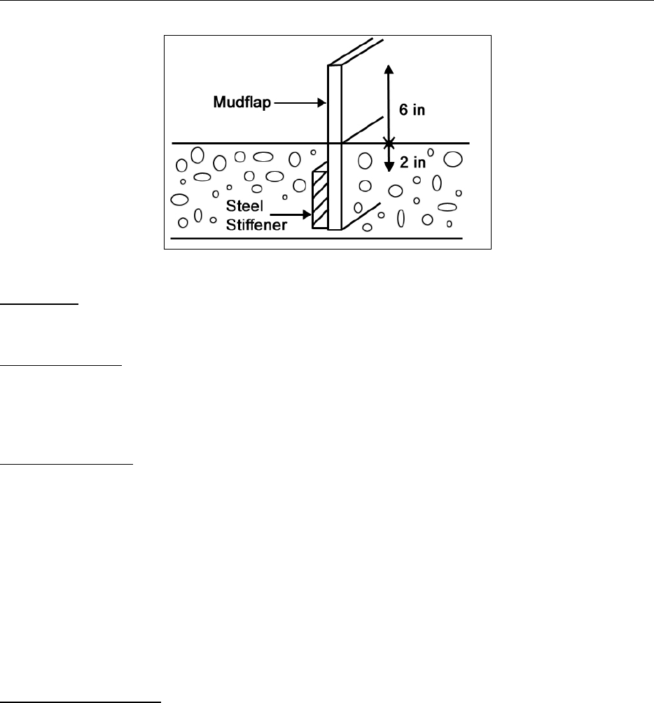
Road Prism is the area of the ground containing the road surface, cut slope, and fill slope. See
Figure 3.6.
B3-25

Forest Roads Board Manual-8/2013
Figure 3.6 Diagram showing the road prism.
Sediment traps are small temporary pooling areas, which collect and store sediment before
diverting runoff water onto the forest floor. Sediment traps are usually excavated or constructed
earthen embankments with a gravel outlet. Examples include:
Check dams constructed in a ditch to decrease flow velocities, minimize channel scour,
and capture and store sediment.
Dead sumps are sediment traps without an outlet.
Silt fence is a tightly woven plastic fabric that comes in long rolls. The fabric is strung between
wooden stakes. Silt fences are often used adjacent to waterways to prevent sediment from
entering water. They are also used adjacent to disturbed soil areas to control erosion.
Spoils are excavated soils deposited in approved waste soil areas.
Straw blankets are made of straw stitched to a single net.
Straw wattles are tubes of straw used for erosion control, sediment control and runoff control.
Wattles help to stabilize slopes by shortening the slope length and by slowing, spreading, and
filtering overland water flow. This helps to prevent sheet erosion as well as rill and gully
development, both of which occur when runoff flows uninterrupted down a slope.
Slash filter windrows are erosion control structures constructed of piled slash in a continuous
row along the base of fill slopes. They are especially useful on fill slopes above water crossing
culverts to catch road surface runoff that is flowing on the outside of the road.
B3-26

Board Manual - 8/2013 Forest Roads
RESOURCES
British Columbia Ministry of Forests, Forest Practices Code of British Columbia, Forest Road
Engineering Guidebook, Second Edition, June 2002. www.gov.bc.ca/
Fifield, Jerals S. (2002). Field manual on sediment and erosion control best management
practices for contractors and inspectors. Forester Communications. (Preface states that no part of
book can be reproduced or utilized in any form or by any means, electronic or mechanical,
including photocopying, recording, or by any information storage and retrieval system, without
written permission from the publisher.)
Johansen, David Kim, 1997. Relief Culverts. San Dimas Technology and Development Center.
United States Department of Agriculture, Forest Service, Technology and Development
Program. 9777 1812-SDTDC.
Minnesota Forest Resources Council: http://www.frc.state.mn.us
National Council for Air and Stream improvements, Inc. (NCASI). 2000. Handbook of
control and mitigation measures for silvicultural operations. Unpublished draft Technical
Bulletin. Research Triangle Park, NC: National Council for Air and Stream Improvement, Inc.
Oregon Department of Forestry, Forest Roads Manual, June 2000.
USDA Natural Resources Conservation Service. 1996. Engineering Field Handbook - Stream
bank and Shoreline Protection. Part 650, Chapter 16. [local NRCS office]
USDA Natural Resources Conservation Service. 1996. Watershed Technology Electronic
Catalog. [//www.wcc.nrcs.usda.gov/wtec/wtec.html]
USDA Forest Service (USFS). 2000. Water/Road Interaction Technology Series: “Diversion
Potential at Road-Stream Crossings”; “Response of Road-Stream Crossings to Large Flood
Events in Washington, Oregon, and Northern California” By M. Furniss et al., Technology and
Development Program. San Dimas, CA. [(909)599-1267]
Washington State Department of Ecology, Permit Assistance Center, http://www.ecy.wa.gov
Washington Department of Fish and Wildlife.
2003. Design of Road Culverts for Fish Passage. Bates, K.M. et al.
http://wdfw,wa,gov/publications/00049/wdfw0049.pdf Wetland plant indicators:
http://plants.usda.gov
B3-27
